Tucked away in the quiet village of Paksebali, just five minutes east of Semarapura town, lies one of Bali’s most photogenic and hydro-technologically fascinating landmarks: Tukad Unda Dam (Bendungan Tukad Unda). Stretching across Bali’s most voluminous river, this multi-tiered concrete spillway weir transforms rushing mountain river water into a breathtaking, uniform sheet of cascading liquid silk—earning it the affectionate moniker "The Great Water Curtain of Bali."
For photographers and visual storytellers, Tukad Unda offers an irresistible visual spectacle: symmetrical cascades of sparkling river water framed by lush emerald bamboo groves, coconut palms, and local village children leaping playfully through the shallows. Yet behind its widespread popularity on social media, Tukad Unda is a marvel of agricultural civil engineering, serving as the critical diversion lifeline feeding dozens of ancient UNESCO-recognized Subak irrigation systems across eastern Bali.
This comprehensive guide details the hydraulic significance of the Tukad Unda river system, camera gear and exposure settings for capturing the perfect water curtain shot, visiting times, entrance fees, and responsible eco-travel etiquette.
1. Hydraulic Engineering & The Subak Lifeline
Originating on the southern slopes of Mount Agung, Bali’s most sacred active volcano, the Tukad Unda River Basin (DAS Tukad Unda) drains over 230 square kilometers of catchment area, flowing across Karangasem and Klungkung regencies before emptying into the Badung Strait. It is the most water-abundant river in Bali, boasting a massive discharge capacity that sustains communities throughout dry seasons.
The contemporary multi-tiered weir at Paksebali was engineered by the Balai Wilayah Sungai (BWS) Bali-Penida to fulfill three critical civil engineering functions:
- Volcanic Lahar & Sediment Dissipation: Following eruptions of Mount Agung (such as the major 1963 and 2017 events), Tukad Unda acts as the primary natural channel for volcanic mudflows (*lahar dingin*). The stepped dam structure acts as an energy dissipator, breaking the momentum of fast-moving torrents and trapping heavy basalt sediment before it floods coastal towns.
- Agricultural Irrigation (Irigasi Subak): The primary weir diverts controlled volumes of mineral-dense river water into primary and secondary canal systems, irrigating over 1,200 hectares of terraced rice paddies across Banjarangkan, Dawan, and Klungkung districts.
- Domestic & Ecological Balance: Downstream water flow maintains the ecological balance of coastal estuaries and replenishes coastal freshwater aquifers, preventing seawater intrusion along the shores of Kusamba Beach.
2. Photography Guide: How to Capture the Water Curtain
The visual signature of Tukad Unda is the smooth, horizontal sheet of water that flows over the upper concrete crest and falls vertically in a two-stage cascade. Achieving professional-grade imagery requires careful attention to lighting, shutter speed, and equipment choice.
Recommended Gear & Camera Settings:
| Parameter | Recommended Setup | Reason / Effect |
|---|---|---|
| Lens Choice | Wide-angle (16-35mm) & Mid-telephoto (50-85mm) | Wide-angle captures the grand panoramic breadth of the dam; telephoto isolates dramatic water texture and human subjects. |
| Shutter Speed (Silk Effect) | 1/4 sec to 1/2 sec (Long Exposure) | Blurs water into an ethereal, silky liquid curtain while keeping the dam structure and rocks tack-sharp. |
| Shutter Speed (Action Freeze) | 1/1000 sec or faster | Freezes individual suspended water droplets when children dive or splash in the lower basin. |
| Filter | Circular Polarizer (CPL) + 3-Stop Neutral Density (ND8) | CPL cuts harsh water glare and reveals riverbed stones; ND filter allows slow shutter speeds in bright daylight. |
| Support | Sturdy Tripod | Essential for long-exposure stability while standing on damp river stones. |
Optimal Timing and Lighting:
The single best window for photography is early morning between 06:30 AM and 08:30 AM. During these hours:
- Soft morning sunbeams break through the canopy of surrounding palm and bamboo trees, creating delicate light rays (*god rays*) across the water spray.
- Water clarity is at its highest, before upstream rain showers or daily village activities stir sediment.
- Temperatures remain cool, and tourist crowds have not yet arrived.
- Midday (11:00 AM – 02:00 PM) should be strictly avoided due to intense downward equatorial sun, harsh bleached water reflections, and deep black shadows.
3. Village Life and Cultural Interactions
Tukad Unda is not a sterile tourist park; it is a vital communal gathering space for the residents of Desa Paksebali. On warm mornings and late afternoons, you will observe local life unfolding naturally:
- Local children using the smooth concrete apron of the spillway as a natural water slide, laughing and performing backflips into the knee-deep pools.
- Women washing vegetables or collecting smooth river stones (*batu kali*) for garden masonry.
- Balinese couples staging traditional pre-wedding photo shoots (*foto prewedding*) dressed in elaborate royal silk Songket attire holding gold ceremonial umbrellas (*pajeng*).
If local village boys perform water splash stunts for your camera, it is polite and courteous to offer a small financial tip (IDR 20,000 to 50,000) as an expression of gratitude for their enthusiasm and time.
4. Practical Travel Information: Access, Fees, and Safety
- Location: Desa Wisata Paksebali, Kec. Dawan, Kabupaten Klungkung, Bali (roughly 2.5 km east of Kerta Gosa; search "Tukad Unda Dam" on Google Maps).
- Opening Hours: 24 hours public access, but daytime visits between 06:30 AM and 05:30 PM are strongly recommended.
- Entrance & Parking Fees:
- General admission: IDR 10,000 – 20,000 per person (managed by the Paksebali Village Tourism Board).
- Commercial photo shoot fee (pre-wedding / professional fashion): IDR 250,000 – 350,000.
- Scooter parking: IDR 2,000; Car parking: IDR 5,000.
- River Safety Guidelines:
- Monsoon Precautions: Never enter the river basin during heavy rainfall or if upstream skies over Mount Agung are dark gray. Flash floods and sudden surges of brown, sediment-heavy water can occur within minutes.
- Slippery Surfaces: The concrete dam ledge and river boulders are covered in slick green algae. Wear grippy water shoes or step with extreme caution.
- Water Depth: The lower spillway pool is typically knee- to waist-deep during normal dry conditions, making it safe for wading, but keep expensive electronics secured in waterproof dry bags.
5. How to Combine Tukad Unda on a Klungkung Itinerary
Because a photography session at Tukad Unda takes between 45 and 90 minutes, it fits seamlessly into a full-day eastern Bali exploration:
- 07:00 – 08:30 AM: Sunrise photography at Tukad Unda Dam in Paksebali.
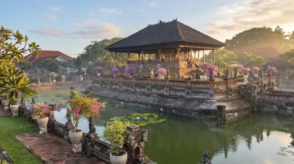
- 09:00 – 10:30 AM: Royal court history and ceiling art at Kerta Gosa & Museum Semarajaya.
- 11:00 – 12:30 PM: Classical Wayang painting studio tour in Desa Kamasan.
- 01:00 – 02:30 PM: Traditional lunch in Semarapura (Serombotan Klungkung).
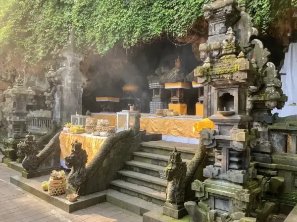
- 03:00 – 04:30 PM: Sacred fruit bats at Pura Goa Lawah and seaside salt makers at Kusamba Beach.
Frequently Asked Questions About Tukad Unda
Is the water at Tukad Unda clean enough to swim in?
The water flows directly from mountain river tributaries. While suitable for wading, splashing, and photography, it carries natural silt and agricultural runoff from upstream farms. It is not recommended for full underwater immersion or swallowing.
Can I fly a drone at Tukad Unda?
Yes. Unlike sacred temple grounds like Goa Lawah or Besakih, recreational drone flights are permitted at Tukad Unda. Always fly responsibly, maintaining a safe distance from overhanging power lines, bridge cables, and local village residents.
Tukad Unda stands as a captivating meeting point of human hydraulic ingenuity and tropical landscape beauty—a hidden gem that showcases the living agricultural heart of Klungkung.